
Planning
 The Planning Department of the Operations Division is committed to the success of District students, families, and faculty by ensuring that present and future generations have access to educational facilities wherein they can both learn and thrive. In close collaboration with state and local governments and organizations, our dedicated team of researchers, analysts, and cartographers gather and interpret geographic-based data that is then translated into student enrollment and capacity forecasts.
We further contribute to the vision and mission of the District by facilitating planning-specific community input meetings, and by creating and maintaining resources such as documents, maps, and school locator tool below.


The following table contain the historic & projected enrollment and current capacity for each of the schools with corresponding attendance area map, if applicable.
School Data Table
| School | Type | Cluster | Area | Enrollment | Capacity | Map |
|---|---|---|---|---|---|---|
| Allgood ES | Elementary | Clarkston | Elementary 3 | 588 | 696 | Map |
| Arabia Mountain HS | High | Magnet and Theme | High | 1274 | 1581 | |
| Ashford Park ES | Elementary | Chamblee | Elementary 1 | 726 | 480 | Map |
| Austin ES | Elementary | Dunwoody | Elementary 1 | 743 | 984 | Map |
| Avondale ES | Elementary | Druid Hills | Elementary 2 | 447 | 648 | Map |
| Barack Obama EMST | Elementary | McNair | Elementary 3 | 901 | 984 | Map |
| Bethune MS | Middle | Towers | Horizon | 665 | 1290 | Map |
| Bob Mathis ES | Elementary | Southwest DeKalb | Elementary 3 | 355 | 480 | Map |
| Bouie Theme | Elementary | Magnet and Theme | Specialty | 601 | 792 | |
| Briar Vista ES | Elementary | Druid Hills | Elementary 2 | 470 | 528 | Map |
| Briarlake ES | Elementary | Lakeside | Elementary 2 | 376 | 480 | Map |
| Brockett ES | Elementary | Tucker | Elementary 2 | 398 | 504 | Map |
| Browns Mill ES | Elementary | MLK | Horizon | 411 | 648 | Map |
| Canby Lane ES | Elementary | Towers | Elementary 3 | 419 | 648 | Map |
| Cary Reynolds ES | Elementary | Cross Keys | Elementary 1 | 253 | 624 | Map |
| Cedar Grove ES | Elementary | Cedar Grove | Elementary 3 | 531 | 672 | Map |
| Cedar Grove HS | High | Cedar Grove | High | 1134 | 1271 | Map |
| Cedar Grove MS | Middle | Cedar Grove | Middle | 714 | 1290 | Map |
| Chamblee HS | High | Chamblee | High | 1827 | 1705 | Map |
| Chamblee MS | Middle | Chamblee | Middle | 951 | 1080 | Map |
| Champion Theme | Middle | Magnet and Theme | Middle | 755 | 780 | |
| Chapel Hill ES | Elementary | Southwest DeKalb | Elementary 3 | 521 | 696 | Map |
| Chapel Hill MS | Middle | Southwest DeKalb | Middle | 620 | 1140 | Map |
| Chesnut ES | Elementary | Dunwoody | Elementary 1 | 513 | 456 | Map |
| Clarkston HS | High | Clarkston | High | 1412 | 1333 | Map |
| Columbia ES | Elementary | Columbia | Elementary 3 | 380 | 696 | Map |
| Columbia HS | High | Columbia | High | 909 | 1426 | Map |
| Columbia MS | Middle | Columbia | Middle | 568 | 1320 | Map |
| Coralwood | Other | Other | Specialty | 215 | 288 | |
| Cross Keys HS | High | Cross Keys | Horizon | 1796 | 1271 | Map |
| DATE | Charter | Charter | Specialty | 766 | ||
| DECA | High | Magnet and Theme | High | 301 | 341 | |
| DeKalb Alternative | Other | Other | Horizon | 173 | ||
| DeKalb PATH | Charter | Charter | Specialty | 368 | ||
| DeKalb Prep | Charter | Charter | Specialty | 562 | ||
| DESA | Elementary | Magnet and Theme | Specialty | 591 | 1080 | |
| Doraville United ES | Elementary | Chamblee | Elementary 1 | 932 | 936 | Map |
| Dresden ES | Elementary | Cross Keys | Horizon | 555 | 696 | Map |
| Druid Hills HS | High | Druid Hills | High | 1429 | 1395 | Map |
| Druid Hills MS | Middle | Druid Hills | Middle | 926 | 1170 | Map |
| DSA | High | Magnet and Theme | High | 302 | 744 | |
| Dunaire ES | Elementary | Clarkston | Elementary 2 | 423 | 672 | Map |
| Dunwoody ES | Elementary | Dunwoody | Elementary 1 | 774 | 960 | Map |
| Dunwoody HS | High | Dunwoody | High | 1979 | 1550 | Map |
| Eagle Woods | Other | Other | Specialty | 36 | ||
| Early Learning Center | Other | Other | Specialty | 262 | ||
| EDC Facilities | Other | Other | Specialty | 26 | ||
| EDC Services | Other | Other | Specialty | 169 | ||
| EDC State Schools | Other | Other | Specialty | 3 | ||
| E L Miller ES | Elementary | Redan | Elementary 3 | 448 | 648 | Map |
| Elizabeth Andrews HS | High | Magnet and Theme | Horizon | 184 | 0 | |
| Evansdale ES | Elementary | Lakeside | Elementary 2 | 522 | 528 | Map |
| Fairington ES | Elementary | MLK | Horizon | 482 | 600 | Map |
| Fernbank ES | Elementary | Druid Hills | Elementary 2 | 763 | 984 | Map |
| Flat Rock ES | Elementary | MLK | Horizon | 976 | 960 | Map |
| Flat Shoals ES | Elementary | McNair | Horizon | 461 | 600 | Map |
| Freedom MS | Middle | Clarkston | Middle | 1148 | 1290 | Map |
| Globe | Charter | Charter | Specialty | 1037 | ||
| Hambrick ES | Elementary | Stone Mountain | Elementary 2 | 513 | 672 | Map |
| Hawthorne ES | Elementary | Lakeside | Elementary 1 | 344 | 432 | Map |
| Henderson Mill ES | Elementary | Lakeside | Elementary 1 | 526 | 504 | Map |
| Henderson MS | Middle | Lakeside | Middle | 1373 | 1590 | Map |
| Hightower ES | Elementary | Dunwoody | Elementary 1 | 619 | 504 | Map |
| Huntley Hills ES | Elementary | Chamblee | Elementary 1 | 467 | 504 | Map |
| ICS | Charter | Charter | Specialty | 474 | ||
| Idlewood ES | Elementary | Tucker | Elementary 2 | 909 | 768 | Map |
| Indian Creek ES | Elementary | Clarkston | Elementary 2 | 870 | 1224 | Map |
| International Student Center | Other | Other | Specialty | 311 | ||
| ISC Intensive English | Other | Other | Specialty | #N/A | ||
| John Lewis ES | Elementary | Cross Keys | Elementary 1 | 875 | 984 | Map |
| Jolly ES | Elementary | Clarkston | Elementary 2 | 808 | 696 | Map |
| Kelley Lake ES | Elementary | McNair | Elementary 3 | 228 | 480 | Map |
| Kingsley ES | Elementary | Dunwoody | Elementary 1 | 365 | 504 | Map |
| Kittredge Magnet | Elementary | Magnet and Theme | Specialty | 551 | 408 | |
| Lakeside HS | High | Lakeside | High | 2193 | 1705 | Map |
| Laurel Heights | Other | Other | Specialty | 51 | ||
| Laurel Ridge ES | Elementary | Druid Hills | Elementary 2 | 440 | 504 | Map |
| Leadership Prep | Charter | Charter | Specialty | 299 | ||
| Lithonia HS | High | Lithonia | High | 1512 | 1426 | Map |
| Lithonia MS | Middle | Lithonia | Middle | 1073 | 1230 | Map |
| Livsey ES | Elementary | Tucker | Elementary 2 | 378 | 312 | Map |
| Marbut Theme | Elementary | Magnet and Theme | Elementary 3 | 427 | 792 | |
| Margaret Harris | Other | Other | High | 76 | ||
| Martin Luther King Jr HS | High | MLK | High | 1434 | 2046 | Map |
| McLendon ES | Elementary | Druid Hills | Elementary 2 | 312 | 528 | Map |
| McNair DLA | Elementary | McNair | Horizon | 521 | 888 | Map |
| McNair HS | High | McNair | Horizon | 782 | 1674 | Map |
| McNair MS | Middle | McNair | Horizon | 795 | 1200 | Map |
| Midvale ES | Elementary | Tucker | Elementary 2 | 408 | 552 | Map |
| Miller Grove HS | High | Miller Grove | High | 1116 | 1860 | Map |
| Miller Grove MS | Middle | Miller Grove | Middle | 669 | 1110 | Map |
| Montclair ES | Elementary | Cross Keys | Horizon | 634 | 648 | Map |
| Montgomery ES | Elementary | Chamblee | Elementary 1 | 696 | 600 | Map |
| Murphey Candler ES | Elementary | MLK | Elementary 3 | 492 | 648 | Map |
| Narvie Harris Theme | Elementary | Magnet and Theme | Specialty | 565 | 816 | |
| Oak Grove ES | Elementary | Lakeside | Elementary 1 | 389 | 504 | Map |
| Oak View ES | Elementary | Cedar Grove | Horizon | 695 | 960 | Map |
| Oakcliff Theme | Elementary | Magnet and Theme | Specialty | 650 | 672 | |
| Panola Way ES | Elementary | Miller Grove | Horizon | 631 | 840 | Map |
| Peachcrest ES | Elementary | Towers | Horizon | 650 | 984 | Map |
| Peachtree MS | Middle | Dunwoody | Middle | 1197 | 1230 | Map |
| Pine Ridge ES | Elementary | Stephenson | Horizon | 592 | 840 | Map |
| Pleasantdale ES | Elementary | Lakeside | Elementary 1 | 688 | 984 | Map |
| Princeton ES | Elementary | Stephenson | Elementary 3 | 770 | 936 | Map |
| Rainbow ES | Elementary | Southwest DeKalb | Elementary 3 | 317 | 648 | Map |
| Redan ES | Elementary | Redan | Elementary 3 | 542 | 696 | Map |
| Redan HS | High | Redan | High | 1003 | 1736 | Map |
| Redan MS | Middle | Redan | Middle | 637 | 1290 | Map |
| Robert Shaw Theme | Elementary | Magnet and Theme | Specialty | 314 | 504 | |
| Rock Chapel ES | Elementary | Stephenson | Elementary 3 | 541 | 696 | Map |
| Rockbridge ES | Elementary | Stone Mountain | Elementary 2 | 940 | 984 | Map |
| Rowland ES | Elementary | Towers | Elementary 3 | 389 | 552 | Map |
| Sagamore Hills ES | Elementary | Lakeside | Elementary 1 | 428 | 456 | Map |
| Salem MS | Middle | MLK | Horizon | 924 | 1200 | Map |
| Sequoyah MS | Middle | Cross Keys | Middle | 1591 | 1170 | Map |
| Shadow Rock Center | Other | Other | Specialty | 5 | ||
| Shadow Rock ES | Elementary | Redan | Horizon | 497 | 648 | Map |
| Smoke Rise ES | Elementary | Tucker | Elementary 2 | 536 | 984 | Map |
| Snapfinger ES | Elementary | Columbia | Horizon | 425 | 864 | Map |
| Southwest DeKalb HS | High | Southwest DeKalb | High | 1213 | 1922 | Map |
| Stephenson HS | High | Stephenson | High | 1314 | 2077 | Map |
| Stephenson MS | Middle | Stephenson | Middle | 840 | 1440 | Map |
| Stone Mill ES | Elementary | Stone Mountain | Horizon | 562 | 672 | Map |
| Stone Mountain ES | Elementary | Stone Mountain | Horizon | 446 | 600 | Map |
| Stone Mountain HS | High | Stone Mountain | High | 1222 | 1209 | Map |
| Stone Mountain MS | Middle | Stone Mountain | Middle | 986 | 1410 | Map |
| Stoneview ES | Elementary | Lithonia | Horizon | 770 | 720 | Map |
| Tapestry | Charter | Charter | High | 300 | ||
| The Museum School | Charter | Charter | Elementary 2 | 587 | ||
| Toney ES | Elementary | Columbia | Elementary 3 | 222 | 600 | Map |
| Towers HS | High | Towers | Horizon | 769 | 1302 | Map |
| Tucker HS | High | Tucker | High | 1596 | 1736 | Map |
| Tucker MS | Middle | Tucker | Middle | 1175 | 1170 | Map |
| Vanderlyn ES | Elementary | Dunwoody | Elementary 1 | 445 | 552 | Map |
| Wadsworth Magnet | Elementary | Magnet and Theme | Specialty | 265 | 600 | |
| Woodridge ES | Elementary | Miller Grove | Horizon | 411 | 504 | Map |
| Woodward ES | Elementary | Cross Keys | Elementary 1 | 545 | 696 | Map |
| Wynbrooke Theme | Elementary | Magnet and Theme | Specialty | 559 | 840 | |
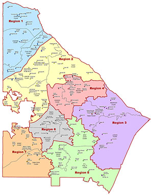
| Area |
School Capacity Calculations
- Capacity Details (2014-05-20) (archive)
- Capacity Summary (2014-05-20) (archive)
- 06-21-2012: MGT Capacity of Schools (archive)
2015—2016 School Year
2010—2011 School Year
- Vision 2020: redistricting/school consolidation